New StoryMap approach to inform UN/EU on weapons trafficking wins Conflict Armament Research (CAR) a Map Creator Customer Award from Esri UK.
~
Press Release, Aylesbury, 24 August 2021: Conflict Armament Research (CAR), an independent organisation that investigates illicit weapons supplies into conflict zones, has been awarded the 2021 Map Creator Customer Award by Esri UK. The award recognises CAR’s creation of a new StoryMap approach to visually and dynamically communicating its findings to more effectively engage and inform UN and EU policy makers.
Every detail of each weapon or unit of ammunition found by CAR’s field teams working on the ground is documented to solve the puzzle of how it was diverted into a conflict zone. This data is recorded in CAR’s EU funded iTrace global weapons reporting database. CAR’s analysts then link the evidence to the problems being addressed by policy makers and submit reports to help them find solutions.
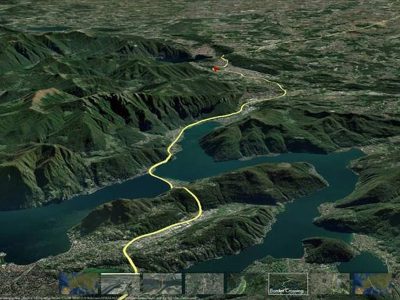
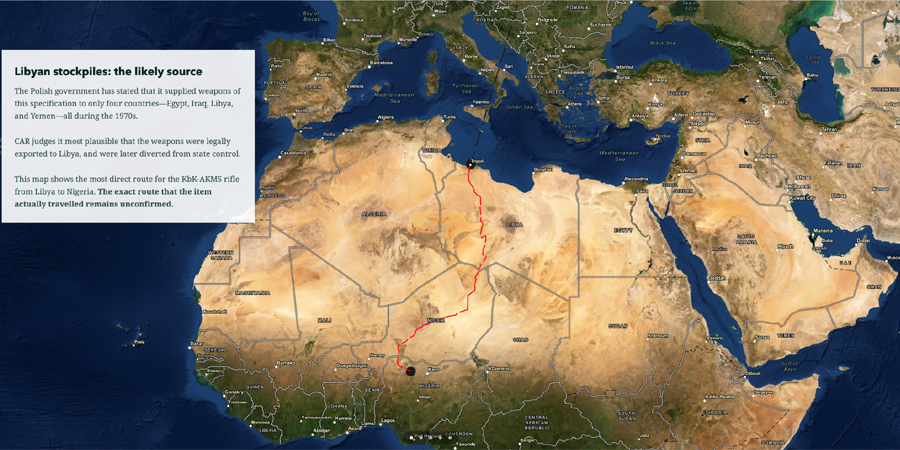
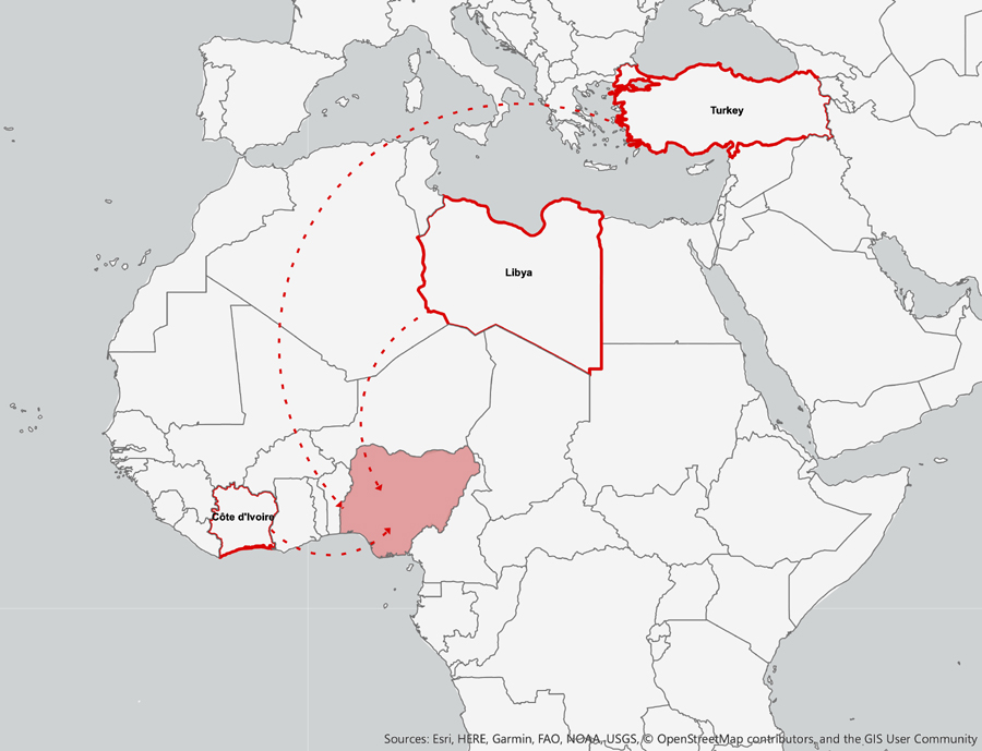
CAR published its first StoryMap using Esri’s ArcGIS Online in February 2020 to report on ‘Nigeria’s herder farmer conflict’ derived from evidence collected through its first field study on the trafficking of weapons and ammunition to armed groups in Northern Nigeria. Rather than the data being locked in a spreadsheet, StoryMap allows CAR to tell a story, explained through three dynamic case studies, of how these groups were being armed. Using Esri’s terrain map CAR can show dynamically the movements of weapons from Turkey, from the Ivory Coast, and from the collapsed state of Libya.
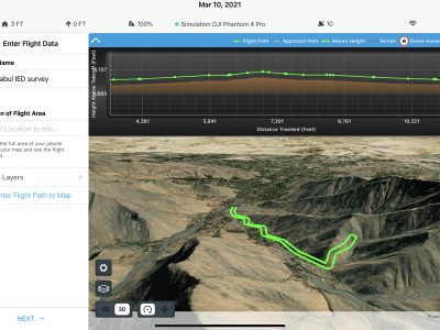
CAR also uses Esri’s ArcGis capabilities for its iTrace dashboard: the world’s largest public database on diverted weapons and ammunition into conflict zones. The dashboard now allows users to see overall documentation trends by type and country across CAR’s global operations. CAR’s analysts were able to create the StoryMap without the need for writing extra code by using Esri’s cartographic tools, such as Living Atlas. They simply created a web map, added text and images, and configured the template files to publish a fully functioning product that can be shared and viewed on any device.
Rob Perkins, CAR’s Head of Research, said: “The evidence that CAR collects is unique and can inform and shape decision making by governments. CAR’s engagement with Esri is great for that as we are able to find new and engaging tools that can take people into our data and understand our findings, and it accelerates our ability to affect positive change, which is really exciting”.
Alex Link, Customer Manager, Esri UK, said, “CAR has transformed the way it can articulate its work, its investigations being inherently geospatial and often involving complex chains of custody or international correlations between items, naturally these can be most effectively communicated through interactive mapping”.