The JFTX (Joint Field Training Exercise) phase of TRIDENT JUNCTURE 2018 (TRJE18) commenced in eastern mid-Norway on Wednesday 31st of October, writes Bob Morrison.
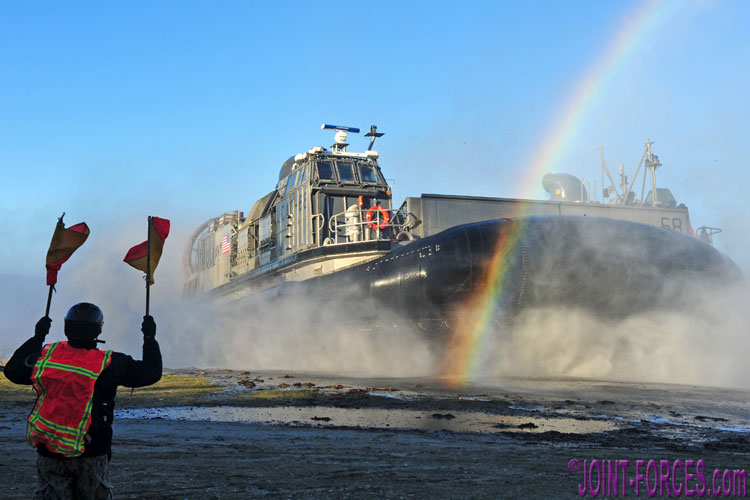
STARTEX, or D-Day, commenced the day after the combined Distinguished Visitors Day and Media Day – held on the southern shore of Trondheimsfjorden, about half an hour to the west of the city the fjord is named after – with the six multinational brigades squaring up to each other roughly two to four hours to the south by road. Although Carl and I joined the JFTX on D-Day itself, we both also managed to get down to Ålvund on the Trongfjorden on D-2 to witness the start of the unopposed US 24 MEU (Marine Expeditionary Unit) landing before independently making our way three hours north for an exercise briefing in Trondheim that night prior to DV-Day on Tuesday 30th.
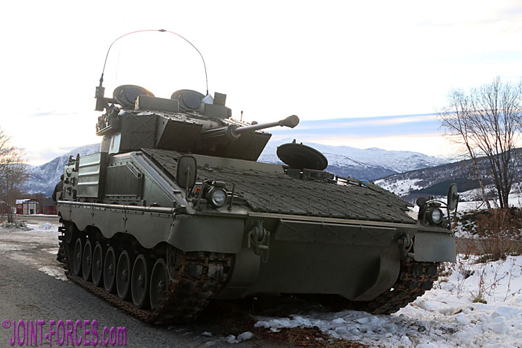
Early in the morning a Spanish Pizarro from the Italian-led multinational brigade (Blue) screens to the west of Oppdal against advancing US Marines (Red) [© Bob Morrison]
The massive field exercise box covered much of the southern half of Trøndelag County and the northern half of Hedmark County, bordering Sweden, plus the northern part of landlocked Oppland County to the east. The terrain in this area is mostly mountainous with deep and roughly north-south valleys channelling road (and rail) communications with only one major east-west road, running from Dombås in the centre of the country to Røros near the Swedish border. To drive between Oppdal and Tynset, the largest towns in the areas where the left and centre opposing brigades would do much of their fighting during the first phase (D-Day to D+3) took around 80 minutes in good weather conditions via the 100km northern route and close to two hours by the 140km southern route; on D+2 the weather conditions on the road over the mountain pass at Hjerkin were so poor that I had to use the mostly lower lying northern route via Kvikne to return to Oppdal after visiting the Italian brigade headquarters at Folldal.
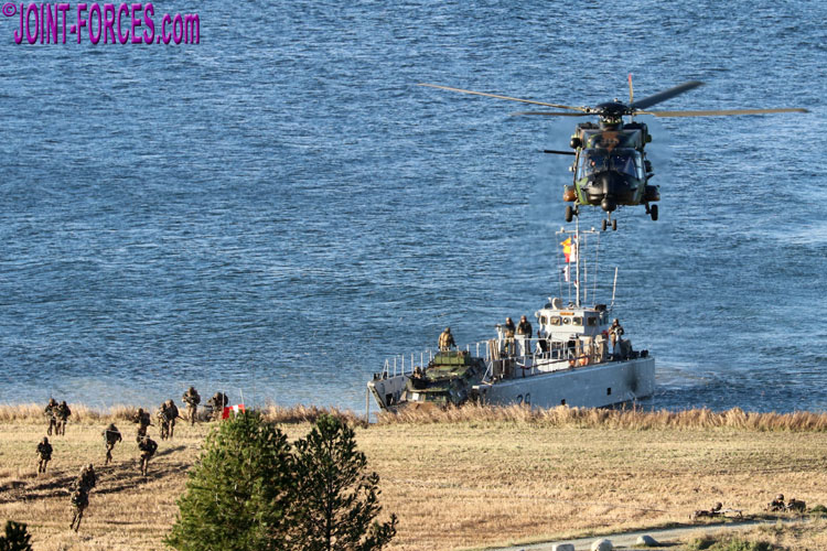
The Dutch-led multinational amphibious task force (Blue) was at the centre of the DV-Day demo for VIPs near Trondheim [© Bob Morrison]
.
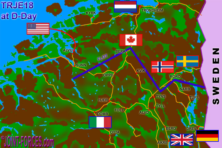
The TRJE18 exercise area with Forward Line Of Troops on D-DAY – towns & villages are red dots with first four letters of name, roads are in orange and most mountainous areas are in brown [© Bob Morrison]
.
On the map I have shown the approximate positions of the three North (Red) Force brigades, the three South (Blue) Force brigades and the North Force Amphibious Task Group, along with the approximate FLOT (Forward Line Of Troops) on D-Day (31st October). Blue Forces were on the defensive and had pushed north to slow down advancing Red Forces; the Italian-led brigade screened to the west of Oppdal and the north of Berkåk, the British-led brigade screened around Telneset north-east of Tynset and the German-led brigade screened in the vicinity of Røros. The Dutch-led Amphibious Task Force was out of play on D-Day as it had been participating in the DV-Day demo but it would rejoin the action later on.
We hope readers now have a grasp of the opening state-of-play for TRIDENT JUNCTURE 18, NATO’s largest FTX (Field Training Exercise) since the end of the Cold War. In future features Carl and myself will concentrate a little more on the action on each axis.
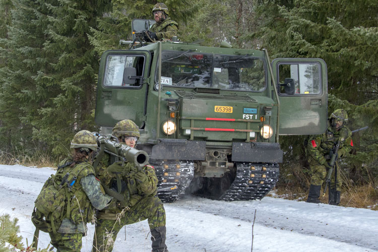
Company B of the 3rd Battalion of Canada’s Royal 22nd Regiment (Red) faced the Italian-led multinational brigade (Blue) on the left north-south axis [AJFC Naples: Sgt Sebastien Frechette]
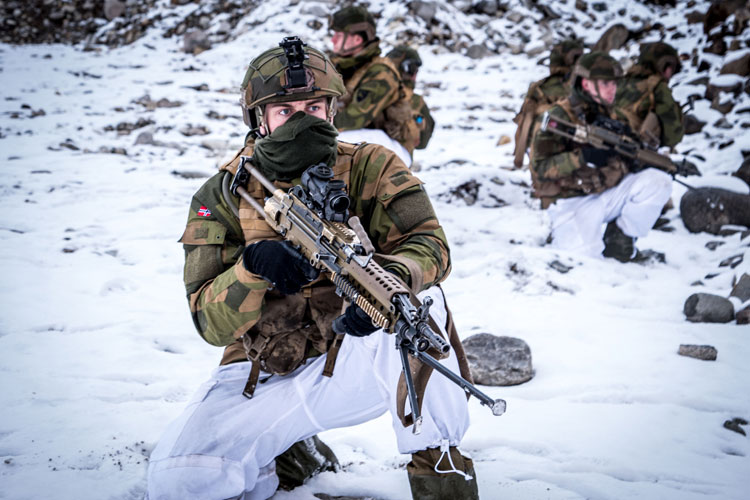
Norwegian Mechanised Infantry (Red) opposed the British-led multinational brigade (Blue) on the centre north-south axis [Norwegian MoD: photographer not known]
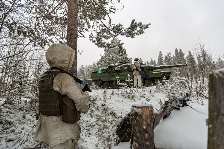
Sweden’s 191st Mechanised Battalion (Red) advanced south against the German-led multinational brigade (Blue) on the right north-south axis [Swedish Armed Forces: Marcus Nilsson]